Areas of Benefit
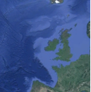
European North-West Shelf Seas and Iberian-Biscay-Irish regional seas
Marine and Coastal Environment: Water Quality, Hydrographic conditions, Marine Biodiversity and Food Webs.
Description of Service
CefMAT is the Cefas Marine Assessment Tool providing scientists access to marine environmental assessments to address policy questions. CefMAT Atlantic Assessments offers a free service that provides data products to support marine assessments in relation to hydrographical conditions, water quality, eutrophication, biodiversity and marine food webs. It uses EO satelites and modelling data from Copernicus Marine Environment Monitoring Service (CMEMS) to provide tailored outputs to assess the state of the seas support the implementation of the Marine Strategy Framework Directive (MSFD).
The specified data sets used from the Copernicus Marine Service are:
- The Atlantic North West Shelf Ocean Physics Reanalysis (NORTHWESTSHELF_REANALYSIS_PHY_004_009)
- The North Atlantic Chlorophyll Concentration from Satellite Observations (OCEANCOLOUR_ATL_CHL_L3_REP_OBSERVATIONS_009_067)
- The Atlantic North West Shelf Ocean Biogeochemistry Reanalysis (NORTHWESTSHELF_REANALYSIS_BIO_004_011)
Other satellite data products are:
- The Ocean Colour from Satellite Observations (OC-CCI)
- The Mean Sea Level Anomalies from satellite Sentinel-2 Multi-Spectral Instrument (MSI Level 1C)
Environmental variables data are processed in CefMAT to generate products that are directly relevant to MSFD assessments.
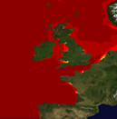
Temperature
Seawater Temperature is a physical characteristic that influences the state of any component of the seas. Data from Copernicus Marine Service is used to assess changes and trends for temperature from 1985 to 2014 at sea surface and near seabed in the North Atlantic Western Shelf. The data products that the user can generate in this service can be used to understand temperature variability and to assess changes in hydrographical conditions and in climate variables
Access Temperature service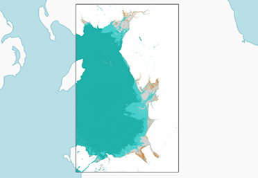
Suspended Particulate Matter (SPM)
SPM in seawater causes an increase of light attenuation through the water column, and can cause reductions in primary productivity, which may change the amount of dissolved nitrogen and other processes. The SPM data products derived from the high spatial and temporal resolution Ocean Colour HIGHROC and Copernicus Marine Service provided in this service can be useful to assess the water quality, hydrographic conditions and eutrophication.
Access SPM service
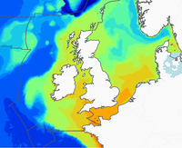
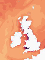
Salinity
Salinity in seawater is an important factor in determining many aspects of the chemistry, biological processes, and living organisms within the sea. Salinity at sea surface and near seabed data from Copernicus Marine Service is used for this service to generate products to assess changes and trends from 1985 to 2014 in the North Atlantic Western Shelf. The salinity data products of this service can be used to better understand hydrographical conditions of the seas, environmental variability and to assess changes in climate variables.
Access Salinity service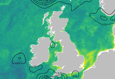
NEAM
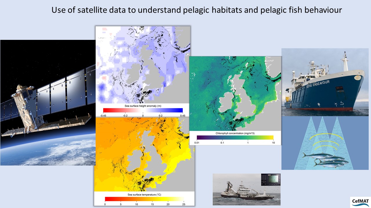
Pelagic Fish and habitats (NEAM)
Pelagic habitat conditions influence the distribution of fish populations. The relationships between pelagic fish distribution and pelagic habitats variables for the North East Atlantic Mackerel (NEAM) was studied by Cefas (Biermann & Couce) using data from satellites. The user can query satellite derived environmental variables for Chlorophyll-a, sea surface temperature and sea surface height to obtain maps showing monthly means of selected environment variables and estimates of fishing activity from 2016 AIS data in the North Sea and Irish Sea. The data product from this service can be used to understand and assess food webs, with special reference to pelagic habitats.
Nitrates
An increase of nutrients in seawater can induce an excessive growth of algae and the process of Eutrophication, which can become a pollution problem and an important pressure in coastal waters. Nitrates (NO3) concentration is used as an indicator to assess the water quality and status for eutrophication. This service enables the users to query estimates of Nitrates concentrations data from Copernicus Marine Service, analyse data to obtain products showing monthly averages and changes from 1990 to 2014 in the North East Atlantic West Shelf. The products from this service can be used to inform water quality and eutrophication assessments.
Access Nitrates service
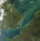
Chlorophyll-a
An excessive growth of algae can influence the process of Eutrophication and affect water quality, especially in coastal waters. Chlorophyll-a is a green pigment from algae used as an indicator of phytoplankton biomass and primary production in water. The concentration of Chlorophyll-a of seawater in the growing season of the year is used to assess the eutrophication status of the seas. This service enables the users to query satellite data for Chlorophyll-a concentrations from Copernicus Marine Service, calculate monthly averages (and 90th percentile) from 1998 to 2014 in the North East Atlantic West Shelf and obtain plots and maps showing changes. The products from this service can be used to inform water quality and eutrophication assessments.
Access Chlorophyll-a serviceThe service is freely available. Users must register to access the service, please use the register button at the top of the page. Feedback can be provided at the CefMAT service desk.
Acknowledgement
Generated using E.U. Copernicus Marine Service information
Acknowledgement
Generated using E.U. Copernicus Marine Service information
News and Highlights
Data supporting policy questions
Data from Copernicus Marine Service on Ocean Colour Satellite observations and Physics and Biogeochemistry reanalysis for the North Atlantic European Western Shelf and used in CefMAT to generate assessment products that can be useful to address questions from the Marine Strategic Framework Directive (MSFD) and Oslo and Paris convention (OSPAR) in relation to hydrographic conditions, water quality and eutrophication, biodiversity and food webs.
Cefas collaborates with the HIGHROC project (HIGH spatial and temporal Resolution Ocean Colour, www.highroc.eu), EUFP7 project (AMD-606797-3) to develop high resolution coastal water products combining in-situ measurements from different platforms, developments in atmospheric correction and parameter estimation to improve the application of ocean colour to coastal areas.
Cefas collaborates with the project Data Cube Services for Copernicus http://dcs4cop.eu to address challenges of handling big data and integrating data streams from sentinel satellite series.

Cefas will lead the data management for biological data involved in building a network of supersites of coastal observatories in Europe including the SmartBuoys (West Gabbard, Warp) together with Deltares (NL), Ifremer (F), RBINS (B), CNRS (F), RWS (NL) at the JERICO-S3 Horizon 2020 Research and Innovation programme providing high-quality marine data, expertise and infrastructures for Europe’s coastal seas http://www.jerico-ri.eu/.